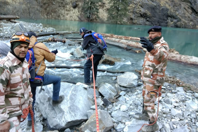
Chamoli (Uttarakhand): After a detailed survey of the natural lake formed in the upper reaches here following the recent floods that wreaked havoc in the region, ITBP and DRDO teams on Saturday completed their inspection and returned to Joshimath.
The teams will submit their report to the Uttarakhand and Central governments very soon.
An Indo-Tibetan Border Police (ITBP) team along with officials of the Defence Research and Development Organisation (DRDO) on Wednesday reached Murenda where the natural lake has been formed.
Teams of the Geological Survey of India (GSI) and Wadia Institute of Himalayan Geology also reached the spot on Saturday after the first team completed its visit to the spot.
The ITBP team will also provide support to the new teams.
"Once surveys of all agencies are complete, reports will be assessed for future course of action," said ITBP Spokesperson Vivek Pandey.
Pandey said that the routes are very risky due to slush, and that only early morning movement is possible. "Various landslide prone areas enroute are a big threat."
The joint team was led by Anil Dabral, Second-in-Command, 1st Battalion ITBP.
Also read: Kumbh 2021 limited to 30 days, to begin on April 1
"The objectives of a joint survey of the newly formed lake over Rishiganga conducted by ITBP and DRDO (SASE) were to assess the feasibility of three basic points that include where any makeshift helipad can be made by the bank of this newly formed lake, any other water channel be made besides the existing water channel through which the water is flowing down from this lake, and if any Geo membrane be laid in the existing water channel to reduce it's depth."
The officer said there is a flash flood deposition (mixture of mud, stone and glacier ice) of length approximately 500 to 550 meter from the confluence point of Raunthi Gadhera and Rishiganga to the mouth of the lake over the Rishiganga.
The mouth of the lake is quite dangerous to cross especially when the sun's rays start falling over this patch which leads to the melting of the glacier ice mixed in the deposition and the deposition starts getting slushy. Any person walking over it may sink in it, said the officer.
"Crossing Raunthi Gadhera is also a bit difficult without some makeshift plank bridge and there are some shooting stones and sliding areas by the bank of Raunthi Gadhera so choosing a safe path is also very important."
The frontage of the newly formed lake is approximately 90 to 100 meter and the length of the lake would be around 500 meters, said Pandey, adding that the width of the water channel through which the water of Rishiganga is flowing out from the mouth of the lake is approximately 10 meter.
The deadly flash floods triggered by a snow avalanche on February 7 had washed away a 520 MW downstream NTPC hydro power project at Tapovan on the Dhauli Ganga river. The avalanche covered approximately 14 sq km area that caused flash floods in the Rishiganga river in Chamoli district.
(IANS)


