Heavy rains pummel several areas in Gujarat, normal life hit
Ahmedabad: Torrential rains pounded several areas in Gujarat on Sunday, leading to water-loggingand disruption of normal life at many places.
As rivers swelled and many lakes overflew, a high alert was sounded for 108 dams, officials said.
An alert has been issued for 14 dams while a warning has been sounded for 17 dams, after they received heavy inflow of water due to rains, they said.
Parts of Mehsana, Patan, Surat, Gir Somnath, Sabarkantha, Ahmedabad, Gandhinagar, Aravalli and Surendranagar districts have been receiving very heavy rains since Sunday morning.
A senior official said 13 teams of the National Disaster Response Force (NDRF) have been deployed while another 13 teams of the NDRF and the State Disaster Response Force (SDRF) are put on standby.
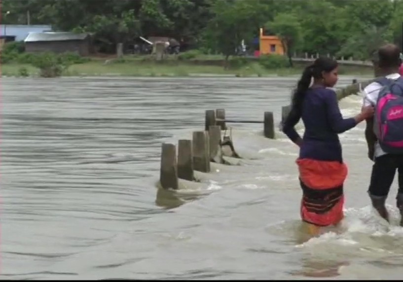
Water-logging caused by intense spells disrupted normal life in Mehsana and Patan besides in Ahmedabad and Gandhinagar.
Low-lying areas in many districts were flooded after several dams and lakes started overflowing, officials said, adding that gates of many dams were opened.
Kadi in Mehsana received 289 mm rainfall between 6 am and 4 pm on Sunday, followed by Becharji (224 mm) in the same district, as per the State Emergency Operation Centre (SEOC).
Sarswati in Patan received 207 mm rainfall while Jotana in Mehsana received 186 mm rainfall, it said, adding that Umarpada in Surat received 185 mm rainfall.
The met department has predicted heavy to extremely heavy rainfall in many districts in north, south and east- central Gujarat and Saurashtra-Kutch till Tuesday morning.
Gujarat Chief Secretary Anul Mukim held a review meeting with officials following the met department''s warning of intense spells.
"As many as 44 rivers and 41 lakes in the state were overflowing due to heavy rains," said Relief Commissioner Harshad Patel.
Out of 205 dams, a high alert has been sounded for 108 dams, while 14 dams are put on alert. A warning has been issued for 17 dams, as per the government.
The Sardar Sarovar Dam is 60.83 per cent full while 68 dams are full to the brim, Patel said.
The state has so far received 94.57 per cent of the average annual rainfall, he said, adding that Kutch received the highest 162 per cent rainfall in the state.
Due to the rainfall, 95 per cent sowing is completed in the state, he said.