ETV Bharat / bharat

Indian army: A plunge from 20,000 feet to ‘Chicken’s Neck’

Keeping in mind the potential threat from China, Indian paratroopers are training vigorously for incisive insertions at the vulnerable and tiny land corridor that links the mainland with the North-East region, writes senior journalist Sanjib Kr Baruah

author img

By

Published : Mar 26, 2022, 1:28 PM IST

Updated : Mar 26, 2022, 6:32 PM IST

Indian army: A plunge from 20,000 feet to ‘Chicken’s Neck’

New Delhi: For the second time in a month, paratroopers from the Indian Army’s Special Forces are having a good go at the vulnerable ‘Chicken’s Neck’, a narrow strip of land that links the Indian mainland to the north-eastern region. At 6 am for two days on Thursday and Friday, 600 tough men of the Special Forces in full battle gear jumped from C-130 ‘Super Hercules’ aircraft from more than 20,000 feet to the dry Teesta river bed that straddles across the Siliguri Corridor.

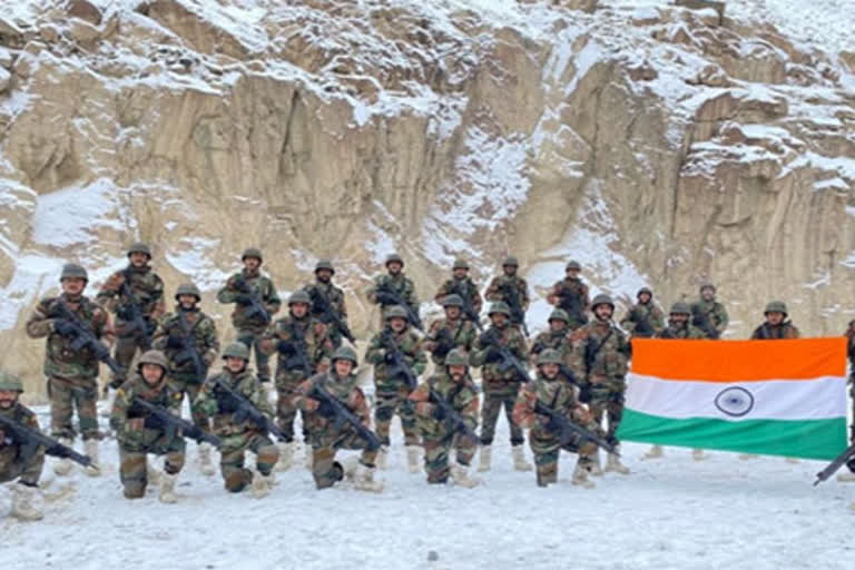
Indian army

The earlier jumps in the same area took place about 22 days ago. Very much alive to the threat of a Chinese intent to make the ‘Chicken’s Neck’ an initial target in times of conflict in order to cut off India’s North-East, the elite of the Indian Army rehearsed their aerial insertion capability and rapid response in the training exercise.

Carrying battle gear and logistic supply loads, an official release said that the large scale para drops involved “advanced free-fall techniques, insertion, surveillance and targeting practice and seizing of key objectives by going behind enemy lines”. The 60-km-long Chicken’s Neck snaking between Bhutan in the north and Bangladesh in the south with 22 km at its narrowest point, is a stretch through which all rail and road links pass through for connecting the Indian mainland with the North-East region.

Read: Army steps up vigil along LAC in Arunachal Pradesh amid increased Chinese activities

The area is close to the Doklam plateau located near the trijunction between India, China-controlled Tibet and Bhutan, the ground zero of a 73-day-long stand-off between Indian and Chinese soldiers in 2017. The Indian security establishment believes that China may be eyeing to gain control of the Jampheri (Zompelri) Ridge, a strategically-important geographical landmass that shoots up by about 500 metres from the craggy and desolate surroundings just north-northeast of the Siliguri Corridor.

In times of conflict, this stretch would be a very vulnerable target for attacks by enemy planes while a Chinese control of the Jampheri Ridge would expose it to heavy artillery fire that would be able to target roads, bridges and also any moving object on the corridor. Greater control in the Doklam plateau and the Jampheri Ridge would also test India’s capability to protect Bhutan thereby weakening India-Bhutan political ties and also putting Bhutan under pressure to toe China’s line.

Satellite pictures have revealed that new Chinese villages believed to have been constructed between May 2020 and November 2021 have come up in the Bhutanese territory, but aligning southwards more towards the Jampheri Ridge, which overlooks the Siliguri Corridor. Interestingly, during the Doklam crisis of 2017, Chinese Foreign Ministry Spokesperson Lu Kang had presented a sketch map of Beijing’s interpretation of the territorial claims that followed the crest of the Jampheri Ridge.

Last Updated : Mar 26, 2022, 6:32 PM IST

For All Latest Updates

ETV Bharat Logo

Copyright © 2024 Ushodaya Enterprises Pvt. Ltd., All Rights Reserved.