

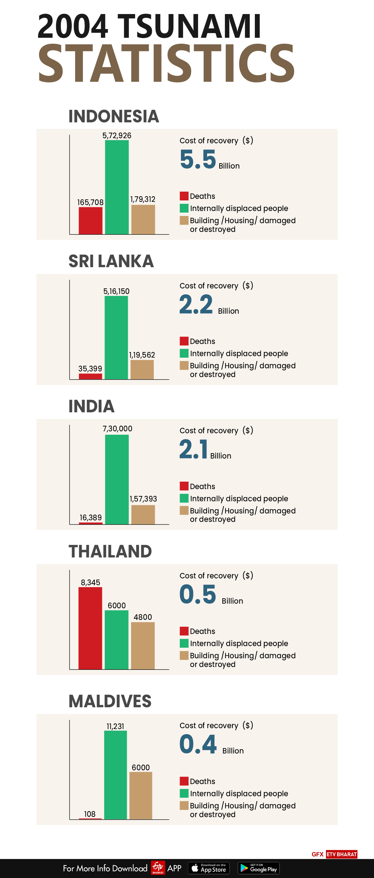
Hyderabad: Fifteen years ago, on a fateful day a catastrophic 9.1 magnitude earthquake struck the coast of the Indonesian island of Sumatra, triggering an unprecedented tsunami that claimed more than 2,30,000 people across 14 countries including India.
The quake was the third-biggest ever recorded, lasting up to ten minutes and causing the Earth to vibrate up to one centimetre.
It also displaced an estimated 30 cubic kilometres of water, unleashing the massive tsunami across the Indian Ocean.
The slippage of about 600 miles (1,000 kilometers) of the boundary between the India and Burma plates off the west coast of northern Sumatra prompted the tsunami on December 26, 2004.
Read also: Tsunami warning as powerful quake hits southwest Indonesia
Unleashed with sufficient force to kill people and destroy property, the tsunami traveled as much as 3,000 miles (nearly 5,000 kilometers) to Africa.
Material losses in the Indian Ocean region were around $10 billion.
Early warning systems against tsunami
Global system
-
The UN-coordinated effort, in place in the Pacific before the 2004 Indian Ocean tsunami, was expanded to the other tsunami-threatened coastlines.
-
The global system, comprised regional warning centres in the Indian, Atlantic and Pacific oceans, and the Caribbean seas, has about 60 standard deep-ocean tsunami detectors that provide data, freely shared among nations for forecasting tsunami impacts.
-
One characteristic of the tsunami warning systems in the Indian Ocean and the Mediterranean Sea is the introduction of multiple regional tsunami service centres providing warning products to all nations of the affected area.
-
The Indian Ocean has three regional centres- India, Australia and Indonesia.
-
Australia and India operate Deep-ocean Assessment and Reporting of Tsunamis (DART) stations and use the US tsunami-centric approach for warning products.
-
Indonesia in cooperation with Germany, uses an earthquake-centric approach, similar to Japan for local tsunamis in Indonesia.
-
The Indonesian/German system uses earthquake information to activate pre-computed simulations to issue warnings.
-
The warnings are then updated once a coastal tide gauge has detected the tsunami.
-
All three regional service providers supply warnings to all Indian Ocean nations.
-
The Mediterranean Sea tsunami warning system uses an earthquake-centric approach, as there are no DART stations currently in the Mediterranean Sea.
-
Distant and local warnings are based on earthquake information only. To verify the existence of a tsunami, the Mediterranean system uses coastal tide gauges.
-
Similar to the Indian Ocean tsunami warning system, five nations – France, Greece, Italy, Portugal and Turkey – will provide regional warning services to subscribing nations surrounding the Mediterranean Sea.
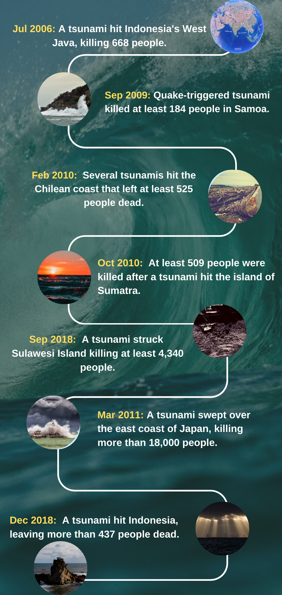
Read also: Palu struggles to recover six months after disasters