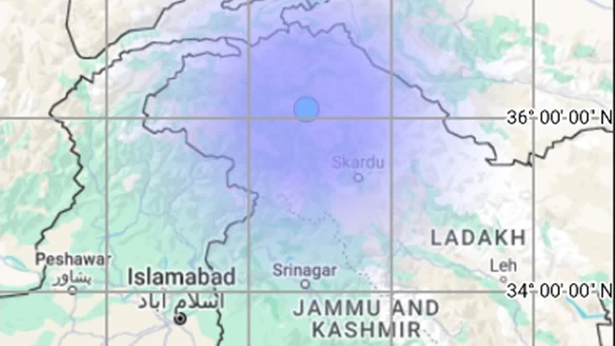
Srinagar (Jammu and Kashmir): An earthquake with a magnitude of 4.4 struck Leh in Ladakh on Wednesday, the National Center for Seismology (NCS) said.
The NCS identified the earthquake's epicenter at Latitude 36.10 North and Longitude 74.81 East, with a depth of 150 kilometers. The quake occurred at 8:12 a.m. local time.
EQ of M: 4.4, On: 03/07/2024 08:12:59 IST, Lat: 36.10 N, Long: 74.81 E, Depth: 150 Km, Location: Leh, Ladakh.
— National Center for Seismology (@NCS_Earthquake) July 3, 2024
For more information Download the BhooKamp App https://t.co/5gCOtjdtw0 @DrJitendraSingh @Ravi_MoES @Dr_Mishra1966 @ndmaindia @Indiametdept pic.twitter.com/wCyW5LRpGH
The NCS provided specifics: "Magnitude: 4.4, Date/Time: 03/07/2024 08:12:59 IST, Latitude: 36.10 N, Longitude: 74.81 E, Depth: 150 km, Location: Leh, Ladakh."
No casualties have been reported so far. Further details are awaited. Leh district of Ladakh falls in the seismic Zone-IV (of Damage Risk Zone) as strike-slip fault runs along Zanskar and Ladakh ranges. The high risk seismic zone coupled with the addition of the extreme climatic and geographical condition, makes Leh district all the more vulnerable to natural disasters.
According to the Ladakh Disaster Management Authority (LDMA), in the last 10 to 15 years, the effects of climate change have become very visible like the devastating flash floods of 2010 and Glacier Lake Outburst Floods (GLOF) in villages like Domkhar, Achinathang, Gya etc. "Hence, it would not be an exaggeration to say that the fast paced infrastructural and communication development has created a hole in the ecology of Ladakh," the LDMA said.
"Ladakh falling in the seismic zone 4, earthquake could well be the most dangerous cause of disaster. Earthquakes measuring 5.4 and 4.9 on Richter scale have hit Leh on 25th and 27th of Sept. 2020 respectively," it added.


