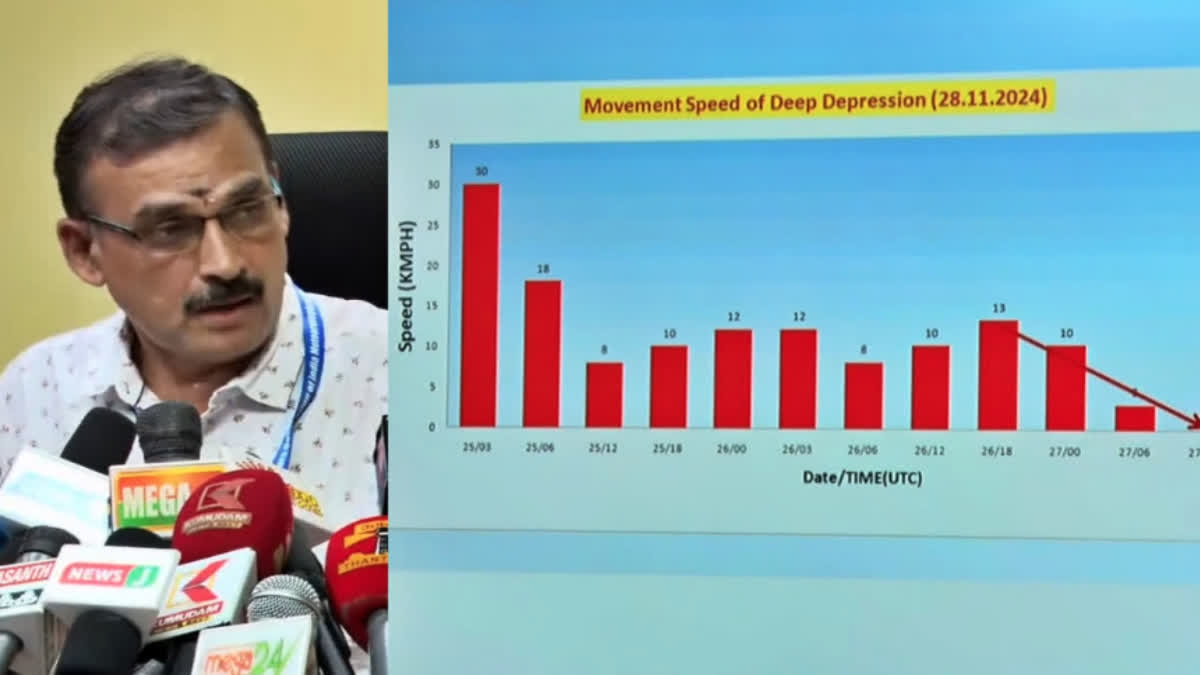
Chennai: The deep depression over the Southwest Bay of Bengal has remained stationary for the past six hours, according to the India Meteorological Department (IMD). It is currently centred approximately 490 km south-southeast of Chennai, 410 km southeast of Puducherry, 320 km southeast of Nagapattinam, and 100 km east-northeast of Trincomalee in Sri Lanka.
IMD predicts that the system will move in a north-northwest direction, intensify into a storm near the Sri Lankan coast within the next 12 hours, and then continue moving north-northwest. It is expected to cross the northern Tamil Nadu-Puducherry coast between Karaikal and Mahabalipuram as a deep depression on the morning of November 30. The system may bring sustained winds of 50–60 kmph, with occasional gusts of up to 70 kmph.
Addressing the media, S. Balachandran, Director of the Chennai Meteorological Center, said, "The low-pressure system has slowed down significantly over the last three days, remaining stationary yesterday. This led to reduced rainfall, and as a result, the red alert was withdrawn."
Balachandran also said that the existing low-pressure area in the Bay of Bengal is expected to temporarily intensify into a storm by this evening, pulling surrounding clouds with it. "This will result in increased rainfall across Tamil Nadu from tonight," he said.
Explaining the categorisation of weather systems, Balachandran noted that wind speeds of around 30 kmph correspond to a low-pressure zone. When the wind speed increases to 31–50 kmph, it is classified as a light storm, and a hurricane is declared when wind speeds reach 51–100 kmph.
"In this case, the wind speed of the depression in the Bay of Bengal is currently 30–35 kmph. It will likely develop into a temporary storm before weakening and crossing the coast between Mahabalipuram and Cuddalore on the morning of November 30," he added.
Read More


