ETV Bharat / state

No man’s land: More than 10,000 live in five Indian villages that don’t exist on the country's map

In West Bengal's Jalpaiguri, there are five villages where residents have all the identification documents but are deprived of land rights. Read on to know why more than 10,000 people of these villages figure on the voter list but not on the map, reports ETV Bharat's Abhijit Bose.

More than 10,000 people residing in the 'Adverse Position' along the Indo-Bangladesh border in Jalpaiguri technically live in India but they are not Indians, at least not when it comes to rights.
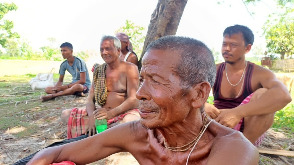
A villager in one of the five villages in West Bengal poses for a picture (Photo: ETV Bharat)
author img

By

Published : Jul 27, 2023, 5:59 PM IST

Updated : Jul 28, 2023, 11:39 AM IST

No man’s land: Five Indian villages that don’t exist on the country's map

Jalpaiguri (West Bengal): More than 10,000 people residing in the 'Adverse Possession' lands along the Indo-Bangladesh border in Jalpaiguri technically live in India but they are not Indians, at least not when it comes to rights.

These people have all the required official documents – Voters Card, Ration Card and Aadhar Card – to prove their nationality but the land they live in doesn't belong to them. They choose people’s representatives but they don’t have the right to sell or purchase their lands. There are pockets along the India-Bangladesh border that have traditionally been under the possession of people of one country in the territory of another country. These are known as 'adverse' possessions.

Interestingly, during the exchange of enclaves (Chitmahal) on August 1, 2015, these five villages under South Berubari Gram Panchayat -- Kajaldighi, Chilahati, Barashashi, Nawtaridebottar and Padhani -- were included in Indian Territory but they are yet to find a place in Indian map making them live literally on a no man’s land.

The problem dates back to the post-independent period when Pakistan claimed that South Berubari, as per the 'Radcliffe Line', should be part of East Pakistan. This claim created unease among the people of Berubari. In early September 1958, talks took place between Jawaharlal Nehru, the Prime Minister of India from 1947 to 1964, and Firuz Khan Noon, the Prime Minister of Pakistan from 1957 to 1958, which further added to the anxiety.

During these discussions, the Nehru-Noon Agreement of 1958 was reached, which explicitly stated that South Berubari would be divided between India and Pakistan, and the enclaves would be exchanged accordingly. However, this agreement faced opposition from the people of South Berubari, and the matter was brought before the Supreme Court of India, causing a halt in the progress of the enclave exchange in 1958.

India attempted to move forward with the exchange by amending its Constitution (9th Amendment, 1960), specifically for this purpose. However, the process was further delayed by several events, including the outbreak of the Indo-China War in 1962, the passing of Nehru in 1964, and the India-Pakistan War in 1965. These events shifted the focus away from the Berubari boundary demarcation.

Also read: West Bengal to build 'correctional home' to rein in 'rogue' elephants

For many decades, India-Bangladesh relations were plagued by the unresolved issue of the land boundary between the two countries. One crucial aspect of this dispute involved dealing with border enclaves, which were small pockets of land completely surrounded by the territory of the neighbouring country. This arrangement complicated administrative control over these enclaves and left their residents essentially ungoverned and disconnected from their home states for nearly seventy years.

In 2015, the Land Boundary Agreement between PM Narendra Modi and his Bangladeshi counterpart Sheikh Hasina facilitated the process of transfer where India transferred 111 enclaves comprising 17,160.63 acres of land to Bangladesh, and reciprocally, Bangladesh transferred 51 enclaves, covering 7,110.02 acres, to India.

The residents were given the option to choose their citizenship in either India or Bangladesh but the fate of these five villages remained partially undecided. Though the international demarcation allowed them to stay inside India they were not allowed to have the land-holding benefits as the area was not shown in the Indian map because of its adverse possession.

"For decades, Kamat village, also known as Chilahati, has been grappling with a significant issue - the absence of land papers for its residents. This predicament extends not just to Kamat but to four other neighbouring villages as well, affecting around 10,000 people in total, out of which 8,000 are registered voters. Despite being entitled to several government schemes designed to benefit farmers, such as the Krishakbandhu Scheme by the State Government and the Kisan Nidhi Samman Scheme by the Central Government, the lack of land documentation has hindered the locals from fully availing these benefits,” former Forward Block MLA and a resident of Chilahati Gobindo Roy told ETV Bharat.

According to Roy, back in 1974 when Indian Prime Minister Indira Gandhi and Bangladesh Prime Minister Sheikh Mujibur Rahman entered into Land Boundary Agreement and the border was redefined, it was found that five Indian villages entered Bangladesh territory while four villages from Bangladesh became part of India. These villages were demarcated as adverse possessions, causing further confusion and challenges for the inhabitants on both sides.

“The people of these five villages started protesting against this as they wanted to stay in India. However, in 2015, a breakthrough occurred with the signing of a land boundary agreement between the two nations. While this development aimed to bring clarity and resolution to the territorial issues, it has not fully addressed the plight of the people in Kamat and the surrounding villages. The villages were included in the Indian territory but the absence of proper land papers continues to be a pressing concern, preventing them from gaining legal recognition of their properties and access to essential services,” Roy added.

When asked about it, the District Magistrate of Jalpaiguri Moumita Godara said, “There are some problems with these villages of South Berubari and it has been informed to the higher authority”.

Also read: Love blooms behind bars: A tale of hope and commitment

Last Updated : Jul 28, 2023, 11:39 AM IST
ETV Bharat Logo

Copyright © 2025 Ushodaya Enterprises Pvt. Ltd., All Rights Reserved.