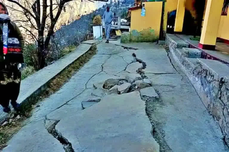
Dehradun (Uttarakhand): Amid Unplanned and uncontrolled construction in the name of development driving Joshimath to the brink of sinking, the state Disaster Management department tasked to mitigate the crisis does not have a base map of the subsidence-hit region. The department has now written a letter to the state's Information Technology Development Agency (ITDA) to make a contour map for them to help them devise its future course for the affected region.
The letter written by the Additional Chief Executive Officer of Uttarakhand State Disaster Management Authority, Savin Bansal to Nitika Khandelwal, Director of ITDA on January 24. Nitika Khandelwal said, "the preparation of contour maps is usually done by the Survey of India or the Uttarakhand Space Application Center (USAC). However, we have taken efforts to prepare a contour map using drones."
Professor MPS Bisht, former director of USAC says, "a base map of any area is required during a disaster or any natural calamity. Every geographical information of the area is integrated on this map." While the natural topography makes places like Joshimath vulnerable to land subsidence, the pressure of human activity has exacerbated it, after which Joshimath started facing frequent landslides, he said.
The cracks developing here came to light only after the local residents raised an alarm which prompted a spot investigation by the disaster management team in August last year and then on January 3. While the fissures have been on an increasing trend in the past six months, the disaster management department has failed to prepare a base map.
Also read: Joshimath: High powered panel meets, presents 3 options
Uttarakhand once had its own Geographic Information System (GIS) lab which was capable of mapping, analyzing, manipulating, and storing geographical data to provide solutions to real-world problems and help in planning for the future. It was established by former Chief Minister Narayan Dutt Tiwari in 2004.
Sunil Badoni who worked as a GIS operator in this lab from 2009 to 2019 said, "after 2019, the GIS lab was abolished after Disaster Management and Mitigation Center (DMMC) was upgraded as Uttarakhand State Disaster Management Authority (USDMA). The services of the technical people working here were also terminated."


