ETV Bharat / state

Explained: What led to Sikkim dam destruction

author img

By ETV Bharat English Team

Published : Oct 5, 2023, 4:52 PM IST

The washing away of the Chungtham Dam in Skkim following a glacial lake outburst flood is a grim reminder of the dangers posed by hydroelectric projects constructed in the seismically active Himalayan region, writes ETV Bharat’s Aroonim Bhuyan.

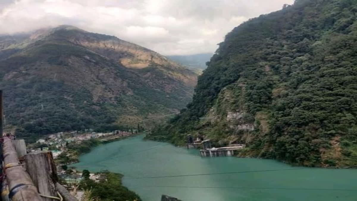
The bursting of the Chungthang Dam in Sikkim caused by a glacial lake outburst flood (GLOF) has served as a grim reminder of the warnings issued by scientists and experts in the past about the dangers of constructing hydropower projects in the c. The Chungthang Dam is the biggest hydropower project in Sikkim. It is part of the 1,200 MW Teesta Stage III Hydro Electric Project. The Sikkim government has a little over 60 per cent in the project, which has a valuation of Rs 25,000 crore. The dam is located in the Mangan district in north Sikkim. It was commissioned in February 2017 and started making profits from last year after generating more power than the expected capacity.
Explained: What led to Sikkim dam destruction

New Delhi: The bursting of the Chungthang Dam in Sikkim caused by a glacial lake outburst flood (GLOF) has served as a grim reminder of the warnings issued by scientists and experts in the past about the dangers of constructing hydropower projects in the c. The Chungthang Dam is the biggest hydropower project in Sikkim. It is part of the 1,200 MW Teesta Stage III Hydro Electric Project. The Sikkim government has a little over 60 per cent in the project, which has a valuation of Rs 25,000 crore. The dam is located in the Mangan district in north Sikkim. It was commissioned in February 2017 and started making profits from last year after generating more power than the expected capacity.

Two glacier-fed rivers, Laching and Lachen, meet at the southern tip of Chungthang to form river Teesta. It is here that the Chungthang Dam was built. So what happened on October 4 that led to the washing away of this dam? It was a GLOF of the South Lhonak Lake located in northwestern Sikkim. It is one of the fastest expanding lakes in the Sikkim Himalaya region and was known to be one of the 14 potentially dangerous lakes susceptible to GLOFs. The lake is located at 5,200 m (17,100 ft) above sea level. It formed due to the melting of the Lhonak glacier. What people initially thought was a flash flood caused by a cloudburst was a GLOF, followed by excessive rainfall.

Then comes the question: What is a GLOF? A GLOF is a type of outburst flood occurring when water dammed by a glacier or a moraine is released. A water body that is dammed by the front of a glacier is called a marginal lake, and a water body that is capped by the glacier is called a sub-glacial lake. When a marginal lake bursts, it may also be called a marginal lake drainage.

In recent days, the South Lhonak Lake has been building up. After receiving the information about this, the Sikkim government sent a team to drain out the lake. But since the lake has been building up abnormally, it was very difficult for the team to siphon the water out. Due to the lack of electricity in the area, centrifugal pumps could not be used. The team placed normal suctioning pipes, but these were not enough.

Also read: Toll rises to 14, 102 people missing as flash flood wreaks havoc in Sikkim; Modi dials CM

The Indian Space Research Organisation (ISRO) on Wednesday issued a statement based on satellite images taken between September 28 and October 4 of the South Lhonak Lake. It referred to temporal changes in the lake area on September 17, September 28 and October 4. “It is observed the lake is burst and about 105 hectares has been drained out, which might have created a flash flood downstream,” the ISRO stated. Which it did, affecting around 15,000 people downstream and washing out eight bridges over the river Teesta, mostly in north Sikkim. Fourteen people have reportedly died and 102 more are missing.

The South Asia Network on Dams, Rivers and People (SANDRP) on Wednesday said the breach of the Chungthang Dam, also shows the failure of the role of the Central Water Commission (CWC) under the Dam Safety Act.“The fact that South Lhonak Lake is vulnerable to create glacial lake outburst flood was known and an embankment has been built to protect the downstream areas,” SANDRP said. “With this knowledge, it becomes even more imperative for CWC to have an early warning system along the Lachen and Lachung rivers.”

The breach of the dam resulted in the release of alarming over five million cubic metres of water that went hurtling down the mountains, causing devastation downstream. This is likely to cause long-term environmental damage and displacement of people, nay communities, downstream. With its abundant water bodies and ideal topography to utilise the resource for electricity generation, the Himalayan region is regarded as the powerhouse of India. Till November 2022, the 10 states and two union territories in the region had 81 large hydropower projects (above 25 MW) and 26 projects under construction. These landslide dams usually result in the impounding of lakes, landslide lake outburst flood, secondary landslides, channel avulsion and formation of flood terraces in the downstream region, affecting the environment and local communities.

The risks posed by landslides in the Himalayas have been aggravated in recent years, making hydropower projects more dangerous and unsustainable. Experts believe that there is an existential need to reevaluate these projects on an urgent basis.

ETV Bharat Logo

Copyright © 2024 Ushodaya Enterprises Pvt. Ltd., All Rights Reserved.