ETV Bharat / state

Yamuna recedes after crossing danger mark in Delhi

Most of the rivers are overflowing due to the rain. The Ganga is flowing above the danger mark in Tehri, Haridwar and Rishikesh. The Alaknanda and the Mandakini are flowing above the danger level in Rudraprayag, Srinagar and Devprayag.

Yamuna recedes after crossing danger mark in Delhi
author img

By

Published : Aug 16, 2023, 10:40 AM IST

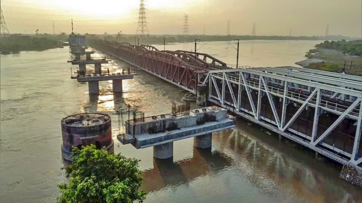
New Delhi: The Yamuna's water level in Delhi followed a downward trend Wednesday morning after the river crossed the danger mark of 205.33 metres for a brief period on Tuesday following torrential rain in the river's upper catchment areas over the past two days. According to the Central Water Commission's (CWC) website, the water level at the Old Railway Bridge stood at 205.14 metres at 8 am on Wednesday.

It had crossed the warning mark of 204.5 metres at 3 pm on Tuesday and rapidly rose to 205.39 metres at 10 pm. "The river may not swell to the evacuation level of 206.00 metres in Delhi unless the hilly region receives more rain," a CWC official said. Delhi recorded light rain on Wednesday and dry conditions are predicted over the next few days.

At least 56 people have been killed in Himachal Pradesh as rain wreaked havoc in the hill state since Sunday. Torrential rain also ravaged Uttarakhand over the past two days, destroying buildings and causing landslides that breached the national highways to Badrinath, Kedarnath and Gangotri shrines. Most of the rivers are overflowing due to the rain. The Ganga is flowing above the danger mark in Tehri, Haridwar and Rishikesh. The Alaknanda and the Mandakini are flowing above the danger level in Rudraprayag, Srinagar and Devprayag, the disaster control room in Uttarakhand's Dehradun said.

In mid-July, Delhi faced unprecedented flooding due to heavy rainfall in the Yamuna's upper catchment areas. The Yamuna swelled to a record 208.66 metres on July 13, breaching its previous record and penetrating deeper into the city than in more than four decades. Over 27,000 people were evacuated during the floods with the losses incurred in terms of property, businesses and earnings running up to crores of rupees.

The river flowed above the danger mark of 205.33 metres for eight days on the trot, starting July 10. Experts attributed the flooding in Delhi to encroachment on the river's floodplain, extreme rainfall within a short span of time and silt accumulation that has raised the riverbed. The Yamuna River system's catchment covers parts of Uttar Pradesh, Uttarakhand, Himachal Pradesh, Haryana, Rajasthan, Madhya Pradesh and Delhi.

The low-lying areas near the river in Delhi, inhabited by around 41,000 people, are considered prone to flooding. Encroachments on the river's floodplain have occurred over the years despite the land belonging to the Delhi Development Authority, the revenue department and private individuals. The city's northeast, east, central and southeast districts are most affected by floods in the city. A study on "Urban Flooding and its Management" by the Irrigation and flood control department identifies east Delhi under the floodplain region and highly vulnerable to floods. (PTI)

ETV Bharat Logo

Copyright © 2024 Ushodaya Enterprises Pvt. Ltd., All Rights Reserved.