ETV Bharat / science-and-technology

Footprints of climate change 'evident' in Himalayas, Karakoram ranges

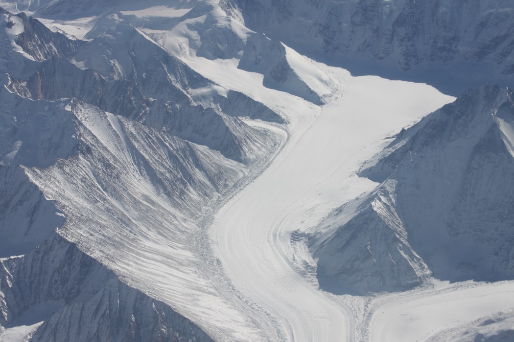
The footprints of climate change are evident in the Himalayan and Karakoram mountain ranges where increased glacial melt, hazardous events, changes in snowfall patterns are all combining to alter the water supplies of downstream countries which depend on rivers emerging from these ranges.

climate change,  Himalayas
Footprints of climate change 'evident' in Himalayas, Karakoram ranges
author img

By

Published : Jun 13, 2021, 8:30 AM IST

New Delhi: New research, Glacio-hydrology of the Himalaya-Karakoram, released in the journal SCIENCE on Thursday, emphasises that total glacier melt and seasonality of flow are projected to increase until the 2050s, with some exceptions and large uncertainties.

Farooq Azam, Assistant Professor at Indian Institute of Technology Indore and lead author of the paper, said, "The melting glaciers of the Himalayan-Karakoram ranges fulfil the water requirements of more than a billion people. This population will be affected when much of the glacier ice mass melts throughout this century and gradually stops supplying the required amount of water."
climate change,  Himalayas
Footprints of climate change 'evident' in Himalayas, Karakoram ranges


"Region-wide, the total impact on each year's water supply varies," Azam adds, "Glacier meltwater, and climate change impacts on glaciers, are more crucial for the Indus basin in comparison to the Ganges and Brahmaputra basins which are predominantly fed by monsoon rains."

"The climate impacts on these two river basins are more due to the changing rainfall patterns."

Analysing a range of modelling studies carried out over the years, the paper shows the impacts of varying climatic conditions on glacier mass in the Himalayan-Karakoram ranges and how it affects the downstream rivers.

Jeff Kargel of the Planetary Science Institute in the US and a co-author of the paper, said, "The research team gathered the results from more than 250 scholarly research papers to arrive at a more accurate understanding -- something approaching a consensus -- of the links between climatic warming, precipitation change and glacier shrinkage."

The study provides a better understanding of the big picture and allows the scientists to identify and target the areas where further field, remote sensing and modelling research is needed.

Among the knowledge gaps researchers identified is a lack of accurate representations of glacier volumes, a detailed understanding of precipitation gradients in the region, and critical studies on permafrost, sublimation, glacier dynamics, black carbon and the role of debris cover.

The researchers recommend a tiered approach to address the identified gaps: Tier-1 includes an expanded observation network that places fully automatic weather stations on selected glaciers.

They also suggest developing comparison projects to examine glacier area and volumes, glacier dynamics, permafrost thaw, and snow and ice sublimation.

Meanwhile, Tier-2 recommendations implement the knowledge of these studies in detailed models of glacier hydrology to reduce the uncertainty in projections of future change.

The Himalayan-Karakoram river basins cover an area of 2.75 million sq km and have the largest irrigated area of 577,000 sq km, feeding five megacities -- Delhi, Dhaka, Karachi, Kolkata and Lahore -- with populations greater than 94 million, and the world's largest installed hydropower capacity of 26,432 MW.

Azam added, "While climate change is causing rapid deglaciation and altering the river stream flows in the Himalaya-Karakoram ranges, it is also contributing to mountain hazards happening more frequently, and the greater magnitude of the latest Chamoli disaster is an argument in favour of avoiding further developments in the fragile mountains of the Himalaya."

Co-authored by Azam, another paper, 'A massive rock and ice avalanche caused the 2021 disaster at Chamoli, Indian Himalaya', also released in SCIENCE journal on Thursday analyses what caused the Chamoli disaster that occurred in February 2021 in the Garhwal Himalaya, resulting in more than 200 people missing or dead and severely damaging two hydropower projects.

The researchers reveal that based on satellite imagery, seismic records, modelling results and eyewitness videos, a 27x106 m3 piece of rock and glacier ice collapsed resulting in an extraordinarily large debris flow that scoured the valley walls up to 220 metres and transported boulders.

The intersection of the hazard and down valley infrastructure increased the severity of the disaster, highlighting the need for adequate monitoring in these regions and sustainable development with environmental impact assessments that take these increasing risks into account.

Dan Shugar at the University of Calgary and the lead author of the paper confirmed that there are no glacial lakes of any size large enough to produce a flood anywhere near the site.

"High-resolution satellite imagery used as the disaster unfolded was critical to helping us understand the event in almost real-time. We tracked a plume of dust and water to a conspicuous dark patch high on a steep slope. This was the source of a giant landslide that triggered the cascade of events, and caused immense death and destruction."

There is consensus among the scientists for both papers that there is a need for improved remote sensing and modelling research to fill the identified knowledge gaps.

With projections of increased risks in this extremely fragile region, be it of river supply variability or disasters like Chamoli, policymakers have to keep associated uncertainties in mind both for development and water governance.

Also Read: TECNO unveils most affordable 48MP dual-rear camera smartphone 'SPARK 7T'

(Inputs from IANS)

ETV Bharat Logo

Copyright © 2025 Ushodaya Enterprises Pvt. Ltd., All Rights Reserved.