ETV Bharat / bharat

'Eye on J&K': Pakistan buys China's Jilin-1 satellite data

Pakistan has purchased real-time satellite data from China, comprising high definition video, optical and hyperspectral imagery, which is competent of providing the precise position of Indian Army camps across the Line of Control in Jammu and Kashmir.

Pakistan buys China's Jilin-1 satellite data
author img

By

Published : Aug 31, 2020, 5:40 AM IST

New Delhi: Pakistan has purchased real-time satellite data from China, comprising high definition video, optical and hyperspectral imagery, which is competent of providing the precise position of Indian Army camps across the Line of Control in Jammu and Kashmir. Intelligence sources said that Pakistan has entered into a contract with China to procure Jilin-1 satellite data for 2020.

The Jilin constellation comprises a network of ten satellites in orbit with the capability of global coverage and it can revisit any location twice a day.
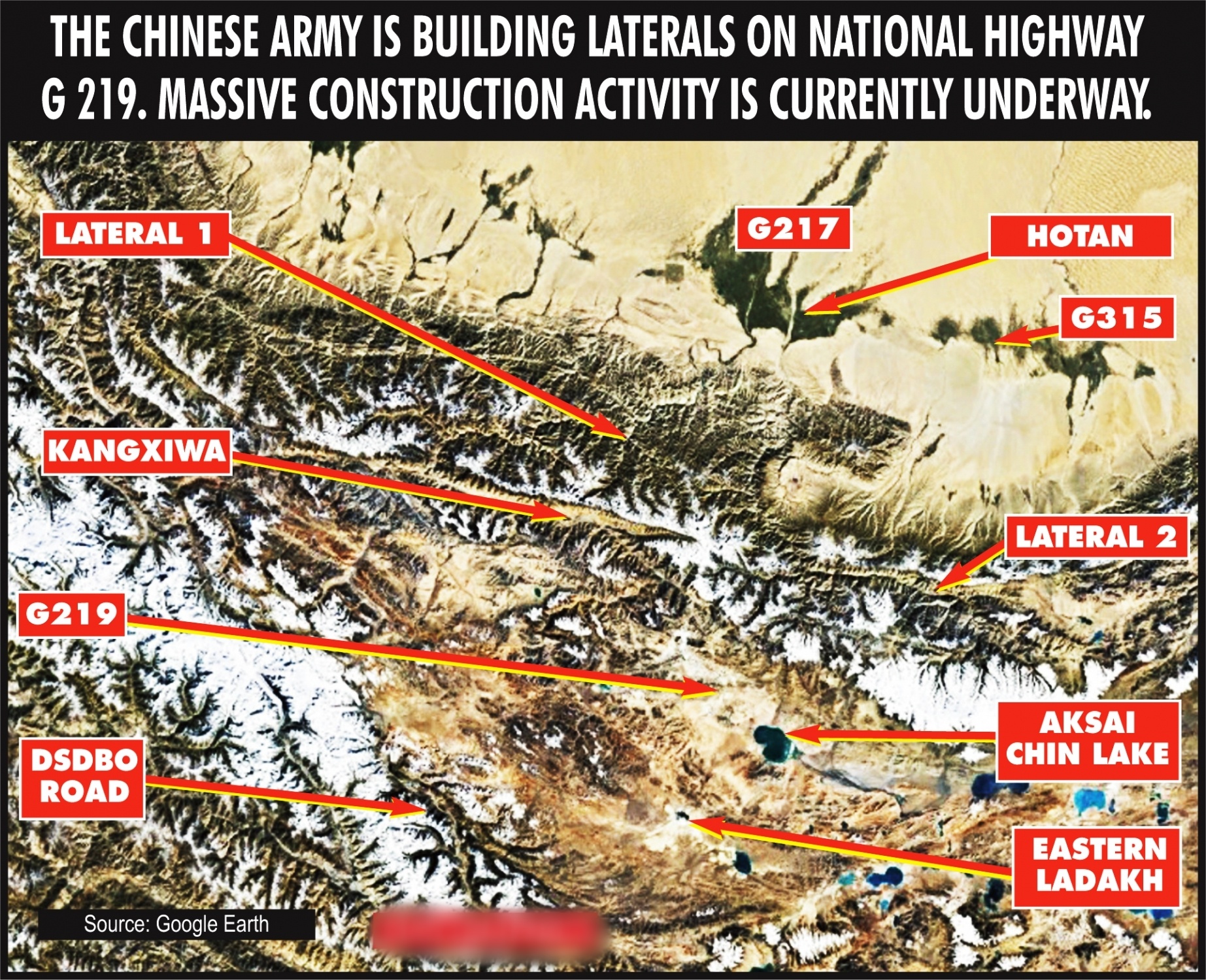
Chinese Army starts massive construction work to keep an eye on India

"Resolution of panchromatic image provisioned by Jilin-1 is 0.72 m and the multi-spectral image is 2.88 m," a source said. Jilin is China's commercial remote sensing satellite run by the Chang Guang Satellite Technology Co. Ltd. In 2019, Pakistan had purchased data of the advanced land observation satellite phased array type L Band synthetic aperture radar and Jilin-1, sources said.

It has stated that it is procuring data for land and resources surveying, monitoring of natural disasters, agriculture research, urban construction and other activities. In 2018, China had launched two remote sensing satellites for Pakistan, claiming that it would monitor the progress of the China-Pakistan Economic Corridor (CPEC).

Also Read: US slaps sanctions on Chinese nationals, firms over South China Sea militarisation

The satellites -- PRSS-1 and PakTES-1A --- were launched using a Long March-2C rocket.

A network of infrastructure projects that are currently under construction throughout Pakistan that will connect China's Xinjiang province with the Gwadar port in Pakistan's Balochistan province, giving China an opening to the Arabian Sea, the 3,218-kilometre CPEC, a dream project of Chinese President Xi Jinping in which China has sunk about $19 billion, runs along the disputed area of Gilgit-Baltistan region of Pakistan-occupied Kashmir (PoK).

Both China and Pakistan are currently are engaged in a confrontation with India at their borders.

For the first time, India finds itself stretched between the border with China where it is locked in an intense stand-off with the People Liberation Army and the border with Pakistan where it faces incessant cross-border firing from the hostile Pakistan Army.

Pakistan increased bombardment of Indian territory, violating the Line of Control (LoC) ceasefire agreement as China started transgressions in eastern Ladakh, creating a two-front war-like situation for India.

(IANS)

Also Read: Post-Galwan clash, Indian Navy quietly deployed warship in South China Sea

ETV Bharat Logo

Copyright © 2025 Ushodaya Enterprises Pvt. Ltd., All Rights Reserved.