ETV Bharat / bharat

IMD predicts heavy rainfall in eastern India, fresh spell of rain likely in Rajasthan

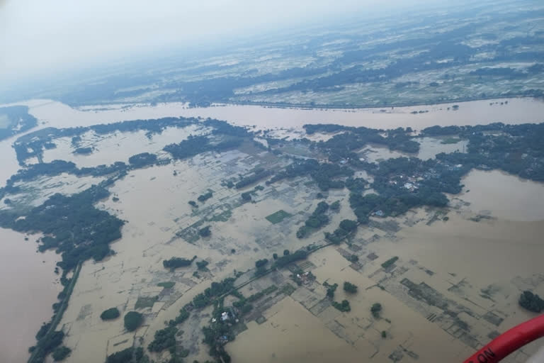
Low-pressure areas have already formed in August, bringing extensive and heavy rain to east, central, and west India. Low-pressure areas are the main rain-bearing systems during the monsoon.

IMD predicts heavy rainfall due to the cyclone in eastern India, fresh spell of rain likely in Rajasthan as temperature increases in North West
author img

By

Published : Aug 19, 2022, 10:34 PM IST

Hyderabad: In Chandigarh, the temperature is continuously increasing in North India including Punjab and Haryana. If media reports are to be believed, Mohali-based IJR has made a big disclosure about the continuous changes in the weather. While in Jharkhand, a red alert was sounded in various regions by the Ranchi Meteorological Centre even as the depression in the Bay of Bengal intensified into a deep depression bringing rainfall in Odisha and West Bengal.

Heavy rainfall has been predicted on Saturday in parts of Jharkhand. Although, the India Meteorological Department (IMD) on Friday rejected the possibility of any cyclone. In northern India too, especially in Rajasthan, the Meteorological Department has predicted a fresh round of heavy rains in several areas due to the pressure system formed along the coast of Bay of Bengal and Bangladesh.

On the other hand in Odisha, as the depression in the Bay of Bengal intensified into a deep depression bringing rainfall in Odisha and West Bengal, the India Meteorological Department (IMD) on Friday rejected the possibility of any cyclone now. Social media was flooded with posts on the possibility of a cyclone following the US Joint Typhoon Warning Center's (JTWC) warning on Thursday that the system has the potential to intensify into a cyclone.

Meanwhile, the Meteorological Department here has predicted a fresh round of heavy rains for several areas of Rajasthan from this weekend due to a new pressure system formed along the coast of the Bay of Bengal and Bangladesh. However, the rain activities in the state have slowed down in the last 24 hours, a MeT Department spokesperson said.

The new weather system is very likely to intensify further into a deep depression and move in a west-northwest direction through Odisha, Jharkhand, Madhya Pradesh, and Uttar Pradesh in the next one-two days, he said. Due to the effect of this system, there will be an increase in rain activities in the districts of Kota, Bharatpur division of east Rajasthan from August 20 onwards.

In the North Western region including Punjab, a higher temperature was recorded, and research has been done by the Indian Institute of Science Education and Research, Mohali by collecting the data of the last 39 years. The researchers have warned Amritsar, Jodhpur, Panipat, Mohali, and Jaipur.

ETV Bharat Logo

Copyright © 2025 Ushodaya Enterprises Pvt. Ltd., All Rights Reserved.