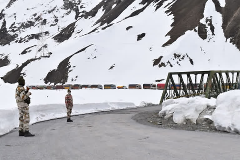
Hyderabad (Telangana): Besides having territorial disputes with India in the Himalayan region, China has recently intruded Ladakh. Tensions continue to escalate between the two nations as Chinese troops have crossed the Line of Actual Control (LAC). Indian and Chinese forces have been altercating in Pangong Tso, Demchok, Galwan Valley and Daulat Beg Oldi. Twenty Indian soldiers have died during the recent faceoff at Galwan Valley. Meanwhile, China claimed its ownership on the Galwan Valley in eastern Ladakh.
The Line of Actual Control (LAC) is a loose demarcation line of 3,440 kilometers that separates India-controlled territory from Chinese-controlled territory. Since the LAC has overlapping territories in many parts, China has resorted to illegal border claims. Frequent scuffles and faceoffs are a common sight here. The LAC is divided into three sectors: western, eastern and middle.
Western sector (from the northwest of Karakoram Pass to Demchok, 1,570 kilometers). Aksai Chin is the most disputed border area between India and China since 1950s. Its area is about 38,000 square kilometers. China has occupied this area in 1957 but India claims the invaded area is part of the Ladakh region. In 1962, China constructed a road cutting across Aksai Chin, connecting Tibet and Xinjiang. Demchok is a village and military encampment in the disputed Demchok sector between India and China. The Indian claimed border extends southeast of Demchok, where Indian and Chinese troops have regular face-offs.
Eastern sector (from Sikkim till the border with Myanmar, 1,325 kilometers). Most disputed territories are in Arunachal Pradesh. But China has claimed Arunachal Pradesh as part of its territory for decades. Asaphila is a 100 square kilometer of forested, mountainous area located in the Upper Subansiri Division.
During the 1962 Sino-Indian War, this area came under direct Chinese onslaught. Presently, this area is not under the occupation of any country. Longju, located in the Upper Subansiri Division is opposite the Chinese military posts in Migyitun, Tibet. In 1959, the first armed battle between China’s People’s Liberation Army (PLA) and Assam Rifles took place here.
India did not reoccupy Longju but set up a post at Maja, 10 kilometers south of Lonju. Namka Chu river valley is located about 60 kilometers ahead of Tawang. This is where the 1962 war began. Sumdorong Chu is a rivulet east of Namka Chu in the area of Kya Pho of Tawang district. The Chinese army occupied it in 1986. As a retaliation to China’s occupation, Indian army has occupied Yangste (part of Tawang district) in the latter half of 1986.
READ: Banning Chinese products will never affect Indian economy: Sudesh Verma
Middle sector (from Demchok till the border with Nepal, 545 kilometers) runs along Himachal Pradesh and Uttarakhand. This region consists of grazing grounds in Uttarakhand’s Chamoli district. This area too has a history of Chinese attacks.
Pangong Tso or Pangong Lake is situated in the Himalayas. It is a 135-kilometer-long lake and extends from India to the Tibetan Autonomous Region, China. It is located at a distance of 54 kilometer from Leh. In the 1962 war, China launched its main offensive from this serene lake. China has built its National Highway by the eastern end of Pangong Tso. This lake is of strategic importance to China in the event of a war with India.
The Galwan River flows from the disputed Aksai Chin region to Ladakh of India. In the 1962 war, Galwan Valley was one of the major areas where Indian and Chinese troops clashed. This river was named after Ghulam Rasool Galwan, a Ladakhi explorer of Kashmiri descent. While India continued its claim on the Aksai Chin plateau, China advanced its claim to the west of the Galwan River.
Daulat Beg Oldi is a military base located in Ladakh. It lies just 9 kilometers northwest of the Aksai Chin. The Indian Air Force landed transports here in 2008, after a gap of 43 years. Post the 1962 war, this became a disputed territory.
Behind its border incursions, China’s imperialistic ambitions are evident. After advancing its claim on eastern Ladakh, China invaded a large part of Demchok-Kuyul sector. Ladakh’s earlier border was at Kegu Naro. Later, Chinese troops gradually advanced till Nagatsang (1984), Nakung (1991), Lungma Serdang (1992) and Skakjung (2008).
In 2000, China has occupied the Chip Chap River, that flows from the disputed Aksai Chin region in Xinjiang, China. In 2013, China again invaded 19 kilometers into India’s mainland. Former Foreign Secretary Shyam Saran said that India lost nearly 640 square kilometers to date to Chinese incursions.
Though the India-China border disputes have a long history, the recent tensions are a result of new developments. India has boosted its border infrastructure as a retaliation to China’s attempts to invade. India has built a 255-kilometer Darbuk-Shayok-Daulat Beg Oldi road. This construction angered China, which in turn destroyed military posts and bridges in Galwan Nala.
Ladakh was recently declared a Union Territory. China criticized this move, asserting its claim on eastern Ladakh. Further, China has complained to the United Nations Security Council, calling Jammu and Kashmir’s reorganization unlawful. Several countries have accused China of spreading the novel coronavirus. The US sought India’s help to probe into the origin of COVID-19.
In an attempt to warn India against allying with other countries, China is resorting to border attacks. At the same time, it is setting up Nepal against India. Further, China pressed Nepal to unveil its new political map featuring Lipulekh and Kalapani.


