ETV Bharat / state

Why Assam Reels Under Floods?

author img

By ETV Bharat English Team

Published : Jul 3, 2024, 7:56 PM IST

Assam has witnessed 13 major floods since 1954. These floods have caused huge damage to life and property. There are several reasons as to why Assam reels under frequent floods.

Why Assam Reels Under Floods?
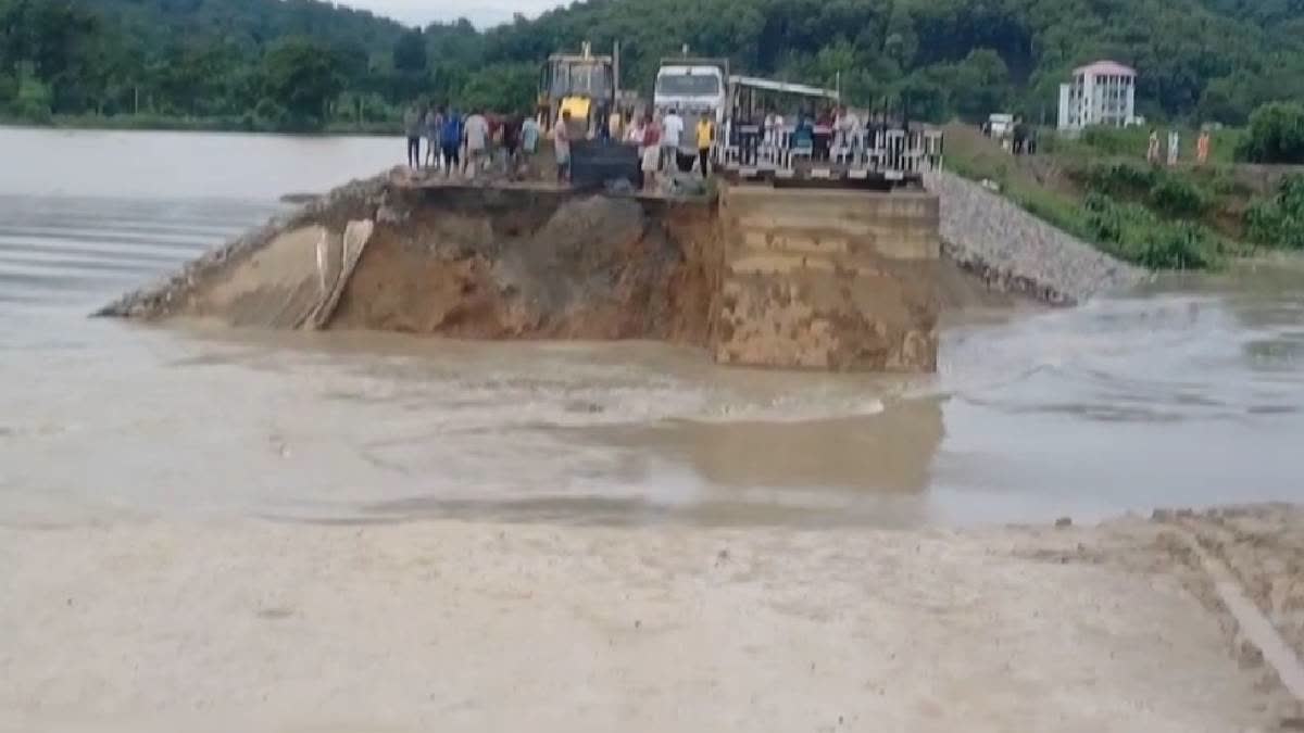
Representational Picture (ETV Bharat/ File)

Hyderabad/ Kaziranga: Assam has been experiencing devastating floods since 1950s with at least half of the districts getting severely hit.

It has been found that nearly 40 per cent of the total area of the state is flood-prone. Major deluges were recorded in 1954, 1962, 1972, 1977, 1984, 1988, 1998, 2002, 2004, 2012, 2019, 2020, 2022 and 2023.

Flood Situation Persisting In Kaziranga National Park:

A total of 187 out of the 233 forest camps are reeling under floodwater. These includes 28 of the 34 forest camps in Agaratali forest area, 52 out of 58 forest camps in Kohora forest area, 37 out of 39 forest camps in Bagori forest area, 13 out of 25 forest camps in Burhapahar forest area and 7 out of 9 forest camps in Bokakhat.

Nine forest camps have been evacuated. So far, two forest camps have been relocated in Agaratali, two in Kahara, three in Bokakhat, one each in Bishwanath and Nagaon. Wildlife including rhinos, elephants, tigers, buffaloes and deer are fleeing to the southern Karbi Hills of the park for shelter amid the rising water levels. The forest department said 24 animals were rescued while four deer died in the floods.

Flood prone areas of Assam:

  • According to the National Flood Commission of Floods, about 40 per cent of the state’s area (31.05 lakh hectares) is flood-prone.
  • As per the Rastriya Barh Ayog (RBA) the flood-prone area is 31.05 lakh hectares against the total area of 78.523 lakh hectares, which is 39.58 percent of the total land area of Assam and 9.40 per cent of the total flood-prone area of the country. It signifies that the flood-prone area of Assam is four times the national mark of the flood-prone area of the country.
  • Nearly 30 per cent of Assam’s land (22.54 lakh hectares) was affected by floods from 1998 to 2015, according to a report by the Indian Space Research Organisation (ISRO). It adds that about 2.2 million hectares suffered damage due to floods at least once during this period.
  • 17 out of 34 districts in Assam are severely affected by flood.
  • Average annual area affected by flood is 9.31 lakh hectares.
  • Since 1954, Assam has experienced more than 13 major and disastrous floods.

Why Is Assam Ravaged by Floods?

Assam with its vast network of rivers is prone to natural disasters like flood and erosion, which has a negative impact on overall development of the state. There are several reasons as to why Assam faces frequent floods.

  • All the rivers in Assam are flood-prone because they receive heavy rainfall in a short period. These rivers are in their early stage of maturity and are active agents of erosion. The river waters collect a tremendous amount of silt and other debris and raise the level of the river beds. Therefore, it becomes impossible for the main channel to cope with the vast volume of water received during the rains.
  • Topography plays a major role for floods in Assam. Most of the rivers flow downstream in the state with excessive force and increases two folds during incessant rains following which, it breaches the embankments.
  • Human intervention in the process hampers the natural flow of water which ends up in floods. Especially during monsoons, Brahmaputra and Barak both flow above danger level. As the water flow increases downstream, rainfall in upstream also contributes to flooding.
  • The Brahmaputra and Barak River with more than 50 tributaries feeding them, causes the flood devastation in the monsoon period each year.
  • Brahmaputra is highly unstable river, due to high sedimentation and steep slopes. Additionally the entire area is earthquake-prone zone and experiences high rainfall.
  • The Brahmaputra river channel due to its braided nature leading to spilling of floodwater; drainage congestion at the outfall of tributaries during the high stage of the main river; and excessive silt load in the river due to soil erosion and large scale landslides in the hilly catchments.
  • The sediment begins to gather at the river's origin in Tibet, as glaciers melt eroding the soil. As the water travels towards Assam, it gathers more sediment, before depositing large amounts of it at the flat plains of the state. The river's other tributaries are said to be ineffectual in dispersing this sediment, leading to massive overflowing, and soil erosion.
  • According to a paper published by the Assam government in 2015, soil erosion has claimed over 3,800 sq km of farmland since 1954, around half the size of Sikkim. Approximately 8,000 hectares of land was being eroded every year.
  • Construction on forest wetlands, destruction of local water bodies and excessive construction of dams are further accentuating the disaster face by the state every year.
  • Massive deforestation in Arunachal Pradesh have further complicated things in Assam.
  • The flood problem of the state is further aggravated due to flash floods by the rivers flowing down from neighbouring states like Arunachal Pradesh and Meghalaya.

Read more

Assam Floods: 11.34 lakh people in 28 Districts Marooned; 38 Dead So far, 3 Drown in Last 24 Hours

ETV Bharat Logo

Copyright © 2024 Ushodaya Enterprises Pvt. Ltd., All Rights Reserved.