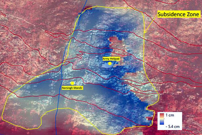
Joshimath:The entire town of Joshimath might be on verge of sinking according to preliminary observations made by the Indian Space Research Organisation. Satellite Photographs shared by ISRO's National Remote Sensing Centre in Hyderabad show the marked area witnessing rapid subsidence has sank 5.4 cm in a period of just 12 days.
While the visuals suggest an alarming situation, the space agency has not made any prediction, it has just stated the pace of sinking and the area affected by it.
The ISRO studied two duration - from April to November 2022, and from December 27 to January 8, 2023. The space agency found that slow subsidence occurred - a maximum of 8.9 cm - over a period of seven months between April and November 2022. While from December to January this year, the pace of subsidence was rapid as land sank 5.4 cm in a period of just 12 days.
"The region subsided around ~ -5 cm within a span of a few days and the areal extent of subsidence has also increased. But it is confined to the central part of Joshimath town," the space agency said.
Joshimath is situated at a height of about 6000 feet above sea level and has its importance from religious, historical and strategic point of view. Joshimath falls in earthquake zone 5.
