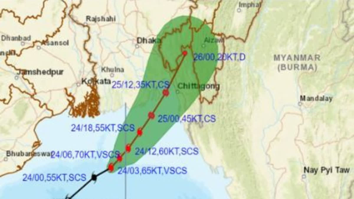
Hyderabad: In a concerning weather update, Cyclone 'Hamoon' has rapidly intensified into a severe cyclonic storm over the northwest Bay of Bengal, prompting the India Meteorological Department (IMD) to issue a series of warnings and alerts. As the cyclone gathers strength, it is projected to continue its north-north-eastward trajectory, with an expected landfall in Bangladesh between Khepupara and Chittagong on Wednesday, October 25, around noon.
The impending cyclonic threat has put seven Indian states, including Odisha, West Bengal, Manipur, Tripura, Mizoram, Assam, and Meghalaya, on high alert, while fishermen have been strongly advised to avoid venturing into the Bay of Bengal until the danger subsides.
The IMD, in its latest report, confirmed that Cyclone 'Hamoon' underwent a significant intensification at around 6 am on the mentioned day, evolving into a severe cyclonic storm. The weather agency took to its official Twitter handle to disseminate this crucial information, stating, "Cyclonic Storm 'Hamoon' intensified into a severe cyclonic storm over northwest Bay of Bengal."
As of 3 am, Cyclone 'Hamoon' had maintained a north-north-eastward trajectory, moving at a speed of 18 kilometres per hour. The storm's centre was positioned over the northwest and adjoining west-central Bay of Bengal, approximately 200 kilometres southeast of Paradip in Odisha and 290 kilometres south-southeast of Digha in West Bengal. This ominous progression called for immediate attention and action by the concerned authorities.
