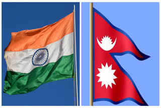
Kathmandu: Nepal on Wednesday officially unveiled a revised political and administrative map of the country showing India's territories of Limpiyadhura, Lipulekh and Kalapani as part of its sovereign territory. The three territories are unresolved between India and Nepal and both claim that they are part of their territory.
Nepal's minister for land reforms and management, Padma Aryal unveiled the revised map during a televised press conference held at the ministry late on Wednesday afternoon.
"We have come to the point of unveiling our revised map which includes the territories which were not incorporated in earlier maps based on ample evidence and proofs collected," minister Aryal claimed in the address broadcast by state-owned Nepal Television.
The updated map including those territories was submitted to the ministry of land management by the Department of Survey which claims to have taken accurate scale, projection, and coordinate system.
The three territories are unresolved between India and Nepal and both claim that they are part of their territory.
Border Row:
The India-Nepal border controversy started in 1997. In this controversy, Kalapani took the centre stage as it was strategically important among three nations India, China and Nepal.
In 1997, India and China's Lipulekh pass decision was challenged by Nepal. The government has ongoing claims to the southern side of the pass, called Kalapani territory, which is controlled by India.
Lipulekh pass was an ancient pilgrimage and trade route designed by the Bhutiya people who lived in the region for centuries. It is situated upon the Kalapani valley a key point of the controversy.
Read more:Nepal sets up post at Chhangru border after India inaugurates Lipulekh link road
Historical Dispute:
King Prithvi Narayan Shah The territorial dispute holds a historical background that dates back to the 1700s when Prithvi Narayan Shah ruled Nepal. He expanded his boundaries to the west beyond the boundaries of India in Uttarakhand. Britain was tightening its grip in India. The two armies clashed in a battle which was concluded by the Treaty of Sugauli in 1816 which separated Kumaon in Uttarkhand from Nepal, making river Kali the boundary between India and Nepal.
Bone of Contention:
- First, the course of the river Kali changes its course significantly like other rivers of Himalayas.
- Since river Kali served as the boundary line between India and Nepal. India, and earlier Britain, consider its origin in the source of northeastern Kalapani streams but on the other side, Nepal declared that it originated in the southwestern Kuthi Yankti streams. Later, the Nepalese king sent a letter that described the southwest of Lipulekh belongs to him for being the source of the river.
- The British surveyors didn't agree based on geography and local nomenclature of River Kali.
Also read:Nepal will reclaim its disputed territories through talks with India: PM Oli
Treaties & Beyond:
In 1954 a trade treaty was signed by India and China, stating their agreement on Lipulekh pass as the Indian gateway.
In 1961 treaty was signed by Nepal and China through which Nepal has declared Tinkar pass as Nepal's point of entry.
In 1962 the Lipulekh pass was closed regarding the concern over Chinese incursions. Nepal remained unknown about the closure.
Later India and China showed their interest in deepening their trade bond which called for the opening of the Lipulekh pass. China also tried to have some foothold in Nepal. China started developing more geostrategic investment in Nepal. At the same time, China-leaning Maoist leaders were gaining importance in Nepal. And therefore Kalapani became the important point between India and Nepal.
Nepal, which was never under colonial rule, has long claimed the areas of Limpiyadhura, Kalapani and Lipu Lekh following the 1816 Sugauli treaty with the British Raj, although these areas have remained in control of Indian troops since India fought a war with China in 1962.
In 2015, Nepal opposed an agreement between India and China to promote Lipu Lekh as a bilateral trade route without its consent. Kathmandu also registered its opposition when New Delhi unveiled a new political map in 2019 that shows some disputed territories, including Lipu Lekh, as part of India.
The publication of the new map comes less than a fortnight after a new road was inaugurated on May 8 by Defence Minister Rajnath Singh connecting the Lipulekh pass in Uttarakhand with the Kailash Mansarovar route in China. Nepal has protested against it and is also considering putting up a security post in the area.
India's Ministry of External Affairs (MEA) had said the road going through Uttarakhand's Pithoragarh district "lies completely within the territory of India".
Also read:Nepal-China ink 18 agreements, 2 letters of understanding
