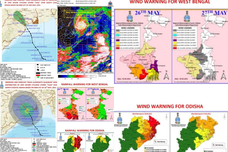
Question: What is the current status of cyclone Yaas? What will be its further movement?
DG: Cyclone Yaas crossed Odisha coast at about 20 km south of Balasore between 10:30 and 11:30 hours IST, today. After landfall, it moved northwestwards and weakened into a severe cyclone around 12:30 hours IST. It will continue to move northwestwards and weakening gradually. It will weaken into a cyclonic storm during the next 3-4 hours.
Thereafter, towards midnight or early hours, it may weaken into a deep depression and tomorrow morning, it will be depression over Jharkhand.
Read:|Cyclone Yaas Live: IMD suggests fishermen to not venture in sea
Question: What was the intensity of cyclone Yaas during its landfall?
DG: The wind speed was about 130-140 kmph gusting to 150 kmph during the time of landfall. This type of wind prevailed, starting from Bhadrak to the Balasore district, as it approached the early morning hours on Wednesday till noon.
Question: What was the estimated impact of cyclone Yaas in the affected areas?
DG: While moving, it will have some partial damaging impact because of its wind speed over the interior districts of Odisha. The coastal districts of Balasore and Bhadrak will have an impact for the next 3-4 hours, in terms of strong winds and also storm surge in low lying areas.
The heavy rainfall has reduced over the coastal areas. However, in the next 6 hours, you can expect heavy rainfall for the coastal districts of Odisha and interior districts of North Odisha will have heavy to very heavy rainfall during the next 12 hours. Similarly, the adjoining districts of West Bengal and Bihar also will get heavy to very heavy rainfall. Jharkhand can get heavy to extremely heavy rainfall on Wednesday and Thursday.
Question:How severe was cyclone Yaas if we compare it with the previous cyclones which formed in the Bay of Bengal?
