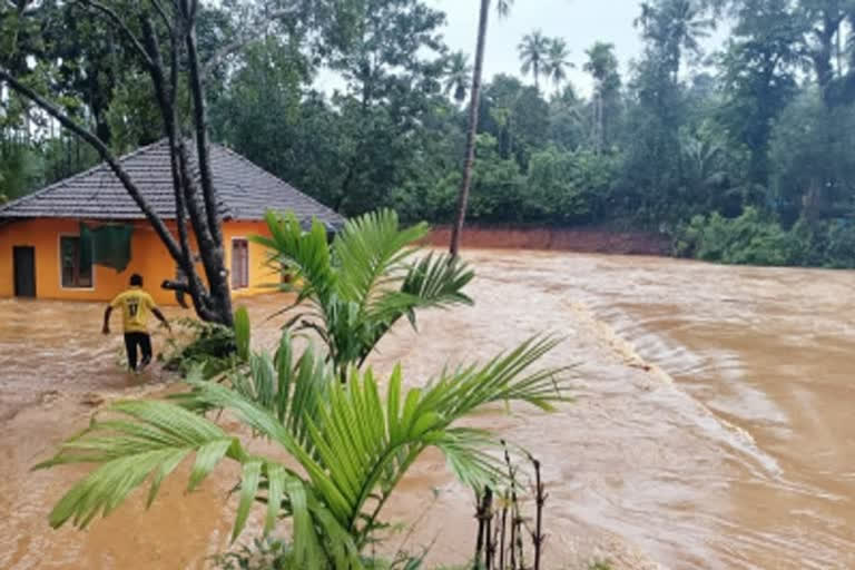
New Delhi/Guwahati/Amravati: Amid flood-like situations in several states due to incessant rains, weatherman has predicted a decrease in the rainfall for the next two days. According to the weather information website Skymet Weather, the Monsoon is presently active in the south of Delhi. There is a Western Disturbance due to which a Cyclonic Circulation is persisting over Pakistan and adjoining Punjab region. Skymet has predicted that these weather activities can be seen with less rain for the next two days.
The weather remained hot and humid in the national capital on Thursday with the maximum temperature settling at 38.4 degrees Celsius, three notches above normal. According to the India Meteorological Department (IMD), very light rain or drizzle occurred in some parts of the city between 8.30 am and 5.30 pm. According to the IMD, the weather is likely to remain the same in Delhi on Friday as well.
An IMD official said that the sky will be generally cloudy with light rain on Friday. The maximum and minimum temperatures will be around 38 and 28 degree Celsius respectively. According to IMD, the area of deep low pressure has now turned into low pressure and is located over interior Odisha and Chhattisgarh. The axis of Monsoon trough is still south of its normal position and is passing through Bikaner, Kota, Guna, Satna, Pendra Road, Jharsuguda and east-central Bay of Bengal towards southeast.
A cyclonic circulation lies over South Pakistan and adjoining areas. During the next 24 hours, there is a possibility of moderate to heavy rain in South Gujarat. Light to moderate rain with isolated heavy rain is possible over southern parts of Madhya Pradesh, Vidarbha, Southeast Rajasthan, parts of Odisha, South Chhattisgarh, Coastal Karnataka, Kerala.
Light to moderate rain with one or two heavy spells may occur over Himachal Pradesh, Uttarakhand, and Telangana. Light to moderate rain may occur over Lakshadweep, Andaman and Nicobar Islands, parts of Odisha, parts of Gangetic West Bengal of Jharkhand, Punjab, Haryana, Rajasthan, Himachal Pradesh and Uttarakhand.
Also read: Monsoon fury continues; Andhra Pradesh on the brink of major flood: 10 points
Light rain is possible over Delhi, Uttar Pradesh, Tamil Nadu, Interior Karnataka, Coastal Andhra Pradesh, parts of Sikkim and Northeast India. Meanwhile, the flood situation in Assam continued to improve on Thursday. However, as per a bulletin issued by the Assam Pradesh Disaster Management Authority (ASDMA)about 2.29 lakh people are still affected by the floods in four districts.
Till Wednesday, more than 2.5 lakh people were affected due to the calamity in five districts of the state. A total of 193 people have died due to floods and landslides in the state so far this year. Cachar is the most affected district, where 1.34 lakh people are affected. It is followed by Morigaon (92,850) and Tamulpur (1,050). Officials said that 175 villages are still submerged in water and crops in an area of 527 hectares have been damaged.
Sixty-one relief camps and distribution centers are running in five districts, where 15,705 people, including 2636 children, are taking shelter. The Godavari river is flowing with a massive 1.7 million cusecs at Sir Arthur Cotton Barrage at Dovaleswaram near Rajamahendravaram and the risk of flooding may increase tonight. In neighboring Telangana's Bhadrachalam, more than 18 lakh cusecs of flood water has been released, which reached the cotton barrage.
Andhra Pradesh Chief Minister Y S Jagan Mohan Reddy conducted an aerial survey on Friday afternoon to assess the devastation caused by the floods. Considering the increase in rainfall and consequent flood level in the upper catchment areas of Maharashtra and Telangana, officials have estimated the release of more than 24 lakh cusecs of water in the next two days.
This will be the worst flood in Godavari after the 1986 floods. A district official said that the flood water may touch 20 lakh cusecs by Friday evening and may increase further the next day prompting protective measures. “We have also identified at least 36 villages that need to be completely evacuated if the floods continue,” he said. Special Chief Secretary G. Sai Prasad is monitoring the situation from the State Emergency Operation Center here.
Meanwhile, the Indian Navy said in a statement that in response to a request received from the Eluru district administration for rescue and relief operations due to heavy flooding of the Godavari river, it sent two UH3H helicopters from INS Dega at Visakhapatnam on Thursday to provide humanitarian assistance to the waterlogged areas of Koida (7 settlements) and Katkur (9 settlements) in Velairpadu Division.
