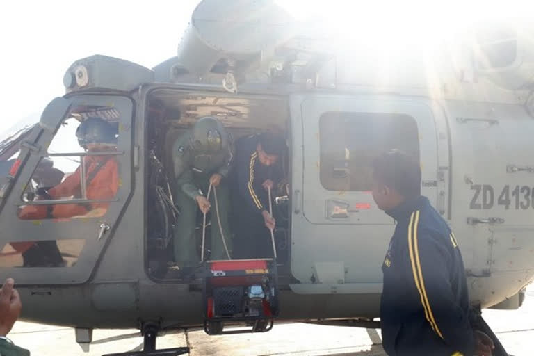
Chamoli (Uttarakhand): In a joint operation by the Indian Navy (IN) and Indian Air force (IAF) on 20 Feb 21, navy divers were winched by IAF Advanced Light Helicopter at a height of 14000 feet above Mean Sea Level to measure the depth of the glacial lake formed 5 km upstream of Tapovan.
The scientists will use this critical data to determine the pressure on the mud wall of the dam.
The naval divers undertook the challenging task of winching down from a helicopter and used a handheld echo sounder (depth measuring equipment) in near-freezing waters.
India measures glacial lake at Uttarakhand Throughout the operation, the IAF pilots maintained accurate positioning in difficult terrain.
Also read:Chamoli tragedy: 61 bodies and 28 body parts recovered so far
Due to the avalanche, there was a formation - an artificial reservoir of water on Rishi Ganga river at a height of 14000 feet.
The water catchment not being natural the administration urgently needed to assess the condition of the catchment by measuring the depth of water. With no road access and time criticality, the diving team were quickly mobilised onboard the IAF Dhruv Advanced Light Helicopter (ALH).
