National

ETV Bharat / bharat

India faces Nepal heat as it battles China in Ladakh region

Krishnanand Tripathi, Deputy News Editor, ETV Bharat reports that Nepal’s decision to stop the flood control work carried out on a river in the East Champaran district of Bihar might further intensify tensions between the two neighbouring countries, especially as it comes in the wake of Nepal government’s decision to approve a new political map this month that includes Kalapani, Lipulekh and Limpiyadhura.

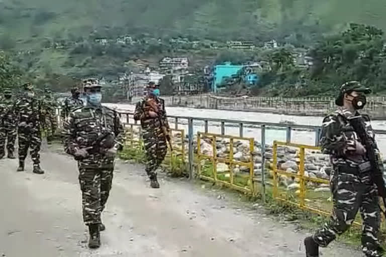
India-Nepal border
India-Nepal border

By

Published : Jun 23, 2020, 11:40 AM IST

Updated : Jun 23, 2020, 6:44 PM IST

New Delhi: With Nepal’s decision to stop the flood control work carried out on a river in the East Champaran district of Bihar this Sunday, the Indo-Nepal relations are set to hit a new low at a time when India is engaged in a fierce war of attrition with China to protect its territory.

This is the second instance this month when problem has surfaced at the border between the two countries. On June 12, an Indian citizen was killed and at least two other were injured when Nepal’s Armed Police opened fire on a group of people in Sitamarhi district of Bihar, which was described by Indian authorities as a ‘local law and order issue’ but the Sunday’s (June 21) development points to a broader problem in bilateral relations.

These incidents, coming in the wake of Nepal government’s decision to approve a new political map this month that includes Kalapani, Lipulekh and Limpiyadhura, underscore a long simmering tension between the two countries.

India-Nepal experts blame the economic blockade of Nepal by India in 2015 for spoiling the bilateral relations while also hinting at the external influence as China seeks to exploit the recent bitterness in India-Nepal relations.

“Third party influence is always there and I think in the recent years the strengthening of Nepal's relationship with China has given encouragement to present Nepalese leadership in many ways,” said SD Muni, a former diplomat and expert on India-Nepal issues.

K Yhome, a senior fellow at Observer Research Foundation in Delhi says Kalapani dispute between India and Nepal is a long pending issue which should have been solved by discussion.

Also read:Nepal obstructing Bihar govt from flood prevention-related work

“The problem is about the origin of the Kali river. India interprets it in a certain way and Nepal interprets in a certain way,” K Yhome told ETV Bharat.

“Border disputes and territorial issues are emotional issues so both sides have not been able to resolve it,” he said.

This is not the first time when Nepal has raised this issue. In 2015 also, Nepal had objected to the inclusion of Lipu-Lekh pass in a joint statement issued by India and China.

“The two sides agreed to hold negotiation on augmenting the list of traded commodities, and expand border trade at Nathu La, Qiangla/Lipu-Lekh Pass and Shipki La,” both India and China said in their joint statement issued on May 15, 2015.

Professor SD Muni, however, rejected the argument of it being an old dispute, as the country did not object to the inclusion of Lipu-Lekh pass in the Panchsheel Agreement signed by India and China in 1954.

“China accepted Lipulekh as India's part not only in 2015 but also in 1954 in the peaceful coexistence agreement in which 8-9 routes were mentioned through which India and China were to have trade and cultural relations,” said Professor SD Muni.

“What the Chinese have done in 2015, they are just reiterating their position. There is a shift in Nepal’s position, not in India's position,” Professor Muni noted.

However, what has surprised many experts and indicates to an external influence is the speed with which Nepal moved to formalize a new political map of the country that includes Indian territory of Kalapani, Lipu-Lekh and Limpiyadhura when Indian and Chinese armies were in a tense stand-off situation in Ladakh.

Last week, 20 Indian soldiers died in a violent face-off with the PLA in the Galwan valley area.

Is it China behind the new map approved by Nepal?
On May 8, Indian Defence minister Rajnath Singh inaugurated a new 80 kilometer long road in Uttarakhand to connect the Line of Actual Control (LAC) at the Tri-junction of India, China and Nepal. The new Greenfield road is expected to reduce the burden of devotees going on Kailash Mansarovar pilgrimage as it takes them right up to the Lipu-Lekh pass between India and China.

The road is also strategically important as it improves the connectivity on Indian side, especially it makes the movement of Indian Army easier in case of a confrontation with China.

The opening of road took place three days after the first brawl took place between Indian and Chinese soldiers in Ladakh region on May 5.

However, immediately after the opening of the new road on May 8, Nepal shot off a protest letter to India saying that it will undermine the understanding between the countries.

“The Government of Nepal has learnt with regret about the ‘inauguration’ yesterday by India of ‘Link Road’ connecting to Lipulekh, which passes through Nepali territory,” Nepal government said in a statement issued on May 9.

Nepal’s sharp reaction surprised many as the road was approved by India in 2005 at a cost of Rs 81 crore and in 2018 its cost was revised to over Rs 439 crore. The road was completed on April 17 this year but its inauguration was delayed to May.

Also read:Exclusive: Govt needs to compromise to settle border row with China, says Kulkarni

It prompted Indian Army Chief General MM Naravane to indicate Chinese involvement behind Nepalese reaction without naming the country.

“We have made a road west of the Kali River. Nepal has accepted its territory is to the east of Kali River. There has never been an issue about the tri-junction,” General MM Narvane said on May 15.

“There is reason to believe that they (Nepal) might have raised the issue at the behest of someone else and that is very much a possibility,” Genera Narvane had said.

As the tension simmered between India and China, Nepal cabinet on May 18 approved a proposal to alter the political map of the country despite strong objections from India.

Last week, both houses of Nepal’s bicameral Parliament approved the new political map showing Kalapani, Lipu-Lekh and Limpiyadhura areas as part of the country.

India has already objected to Nepal’s move as ‘artificial enlargement’ of the territorial claims.

However, the problem did not end with the approval of a new map by Nepal which included Kalapani area in the new map. The recent events also indicate a bid to expand the border dispute with India to newer areas.

This Sunday Nepalese police and district officials stopped the flood control measures taken by the Indian state of Bihar on Lalbakeya River in the East Champaran district. The incident comes in the wake of firing on a group of Indian citizens on June 12 that killed one Indian and injured two others.

Also read:Army officials inspect China-Nepal border in Pithoragarh

The Lalbakeya River originates in Nepal and then flows into the Bagmati River in Bihar’s Sitamarhi district. Bihar has historically suffered heavy damages due to the swelling of rivers flowing from Nepal to India.

India has built several embankments on the river, and they have been fortified every year before the monsoon. However, this year Nepalese authorities have stopped it.

Last Updated : Jun 23, 2020, 6:44 PM IST

ABOUT THE AUTHOR

...view details