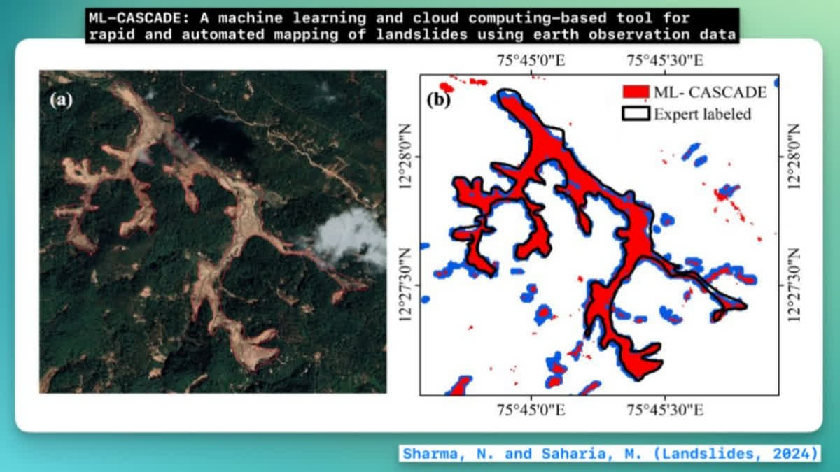
New Delhi: Researchers from the Civil Engineering Department at IIT Delhi have unveiled a groundbreaking tool called ML-CASCADE, which leverages cloud computing and machine learning to quickly map landslide extents using satellite data. This user-friendly tool requires just two inputs: the approximate date and location of a landslide, allowing it to accurately map complex landslide clusters in just five minutes and simpler ones in two minutes, crucial for post-disaster assessments.
Developed by PhD Scholar Nirdesh Kumar Sharma and Prof. Manabendra Saharia, the tool has been detailed in a paper published in the renowned journal Landslides by the International Consortium on Landslides. Traditional methods of landslide mapping are often time-consuming and costly, relying on manual digitisation and field surveys that are impractical in remote areas. ML-CASCADE addresses these limitations by integrating diverse datasets, including satellite imagery, terrain, vegetation, and soil data.
The tool treats landslide mapping as a binary image segmentation problem and employs 19 features, including Sentinel-2 satellite bands and vegetation indices, to detect fresh landslide activity. Unlike existing models that require extensive pre-trained data, ML-CASCADE dynamically builds custom models based on user inputs, enhancing its adaptability to different terrains.
Designed for both technical and non-technical users, the interface allows for easy data downloading in various formats. Utilizing Google Earth Engine for processing, the tool delivers results in minutes rather than hours.
ML-CASCADE has been validated against numerous landslide cases, including significant events in the Himalayas and Western Ghats, and is currently being used by IIT Delhi researchers to create a national historical landslide inventory. This inventory will be essential for developing early warning systems. The tool's innovative architecture also holds promise for future applications in mapping floods, deforestation, and other environmental challenges.
